
Designing the Best Collection Round for the Customer's Geography: A Waste Tender Guide 2026
The round design section is where most waste contractors either win or lose council tenders. Here's how to model your collection rounds for the customer's geography and evidence it in a way evaluators actually credit.
mytender.io Research Team
Tender Writing & Bid Management Specialists
Designing the Best Collection Round for the Customer's Geography
You've read the specification. You've noted the tonnages, the collection frequencies, the vehicle restrictions. You've got your depot location and your fleet capability. Now comes the section that either makes or breaks the bid: collection round design.
Most contractors underestimate it. They describe what they'll do without showing how they've thought about the geography. Evaluators notice.
This guide walks through how to approach round design specifically for the customer's area, how to model it credibly, and how to write it up so evaluators give you the marks.
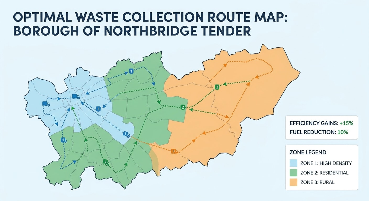
Waste collection route geography map showing colour-coded zones across a council area
Why Round Design Is a Scoring Battleground
Collection round design typically sits inside the methodology or mobilisation section of a council waste tender. It's often worth 15-25% of the total quality score. That's a lot of marks for a section most bidders treat as an operational afterthought.
Evaluators are assessing three things when they read your response:
- Do you understand this particular geography? Generic responses score poorly. Councils know their patch; they'll spot immediately if you've copy-pasted a round design from another contract.
- Is your design operationally credible? Can you actually collect what you're proposing, in the time available, with the fleet you're committing?
- Can you evidence it? Claims without data lose marks. A well-modelled round with supporting data wins them.
The contractors who consistently score well are the ones who do the geographic analysis upfront, then write the tender response around that analysis. Not the other way round.
Start With the Geography, Not the Fleet
The most common mistake is starting with your fleet and working backwards to a round design. You end up with a round designed for your convenience, not the council's geography.
Start with the geography. Pull every piece of data available before you write a word:
- Dwelling count and type. How many properties? What mix of houses, flats, communal sites? The Valuation Office Agency's Council Tax data by local authority gives you this, or use the contract specification if they've published it.
- Collection point density. Urban streets with 80 properties per kilometre behave completely differently to rural routes with 12 properties over 5 kilometres.
- Road network. Low-emission zones, weight restrictions, narrow lanes, school keep-clears. Check the council's interactive mapping tools and the Ordnance Survey data where available.
- Waste stream mix. Residual, dry recycling, food waste, garden waste, bulky. Each stream has different vehicle requirements, container weights, and acceptable fill levels before a vehicle tips.
- Existing round structure. Some specs include the current contractor's round maps. Use them as a baseline, not a template.
This is the groundwork. It takes time, but it's what separates a credible round design from a generic one.
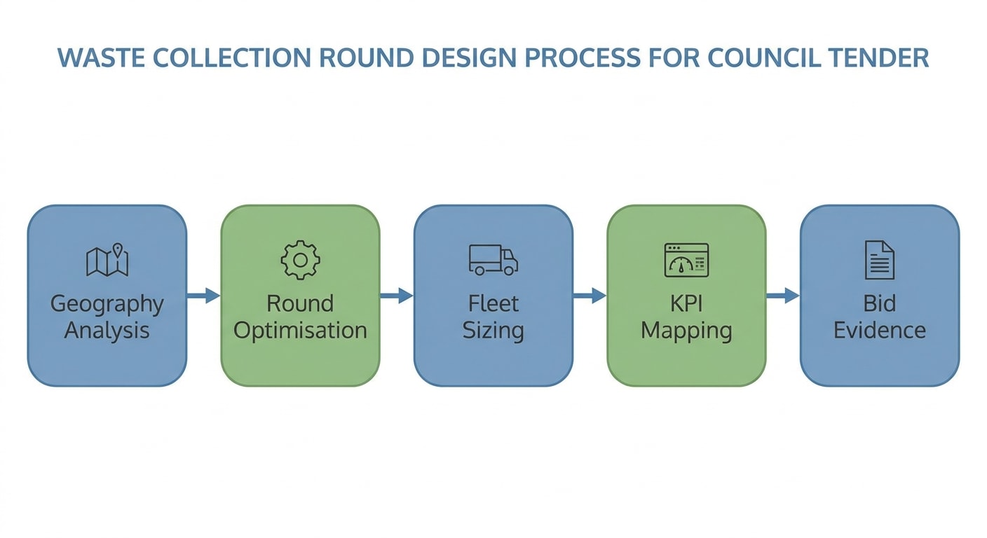
Flowchart showing the collection round design process from geography analysis through to bid evidence
Modelling the Rounds
Once you have the geographic data, you can model your proposed round structure. You don't need to submit GIS-quality maps (though they help), but you do need to demonstrate that you've actually thought through the round boundaries.
The Core Calculation
Every round has a ceiling. The ceiling is the maximum number of properties you can collect in a single shift, defined by:
- Shift length. Typically 7.5 hours paid time minus breaks = 6.5-7 hours operational time
- Drive time from depot to first collection point (and back)
- Collection rate. Urban dense: 600-900 properties per vehicle per day. Rural: 200-400. Mixed: 400-600. These are starting estimates; your historic data from similar contracts should anchor your numbers.
- Payload capacity. Maximum fill before the vehicle needs to tip. For a 26-tonne RCV collecting dry recyclables at 250kg/tonne compaction, your effective payload is typically 6-8 tonnes before a mid-shift tip.
- Transfer station or recycling facility location. Tip time, queuing, and return drive all eat into the shift.
Work out how many rounds you need from first principles, then test whether that makes sense against the geography. If your model says 14 rounds for a 50,000-property contract but the incumbent runs 18, that's a flag: either you're over-claiming capacity, or there's a good reason the spec calls for a particular approach.
Round Boundaries
Round boundaries should follow natural geographic logic: roads, waterways, railway lines, borough boundaries. Don't draw round boundaries that require vehicles to criss-cross each other's territory. Evaluators with local knowledge will clock it.
For mixed-geography contracts (urban core plus rural fringes), consider hybrid rounds that collect the dense urban sections in the morning and extend to rural collections in the afternoon. This can reduce total vehicle count while maintaining service frequency.
Vehicle Types
Match vehicle type to geography. A 26-tonne RCV is efficient on straight urban roads with good access. It's a liability on narrow Cotswold lanes or roads with a 7.5-tonne weight restriction. Your round design should explicitly note where you're deploying what vehicle type and why. This shows geographic awareness. It also de-risks the evaluator's concern about service disruption from access failures.
Evidencing Your Design
A model is only as credible as the evidence behind it. This is where most responses fall short.
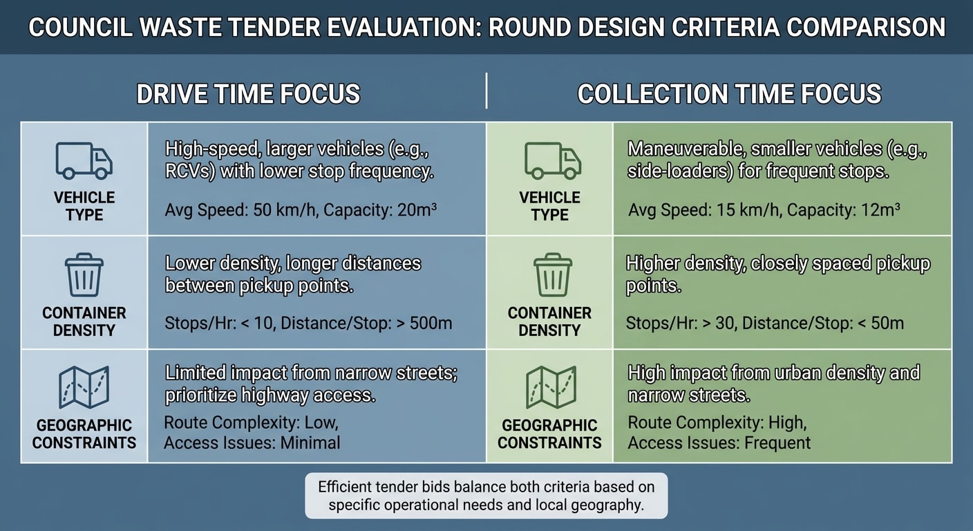
Table showing waste tender evaluation criteria for collection round design, including drive time, vehicle type, container density and geographic constraints
What Good Evidence Looks Like
Route modelling software output. If you've used Paragon, Podaris, or similar route optimisation software, say so and summarise the output. You don't need to submit the full model, but citing the tool and key outputs (total drive time, estimated rounds, average collection rate) adds credibility. Trial run data. If you've run a trial in a comparable geography, use it. "Based on our mobilisation of [Similar Council] in 2024, where we delivered [X] properties across [Y] rounds with an average missed bin rate of [Z]%, our proposed round structure follows the same methodology" is worth more than any generic claim. Benchmarks from comparable contracts. If you can't do a trial, use your existing contract data. Anonymise where necessary but cite it: "Our [Contract Type] operations in [Region Type] consistently achieve [metric]." This shows you're applying real operational data, not theoretical numbers. Depot logistics. Show that your depot is accessible, that fleet allocation is costed, and that maintenance schedules won't affect service delivery. Evaluators are suspicious of round designs that assume perfect fleet availability. Build in realistic downtime allowances.The GIS Map Question
Should you include a map? Yes, if it adds clarity. A simple map showing round boundaries relative to the collection area, depot location, and transfer stations is worth including. It doesn't need to be technically sophisticated. A clear, annotated image that makes the round structure legible is enough.
Don't include a map that contradicts your text. If your map shows 14 rounds but your methodology describes 16, you've created a credibility problem.
Fleet Sizing and the Geography Link
Fleet sizing should flow from your round design, not the other way around. Once you know the number of rounds and the vehicle types required, your fleet commitment follows logically.
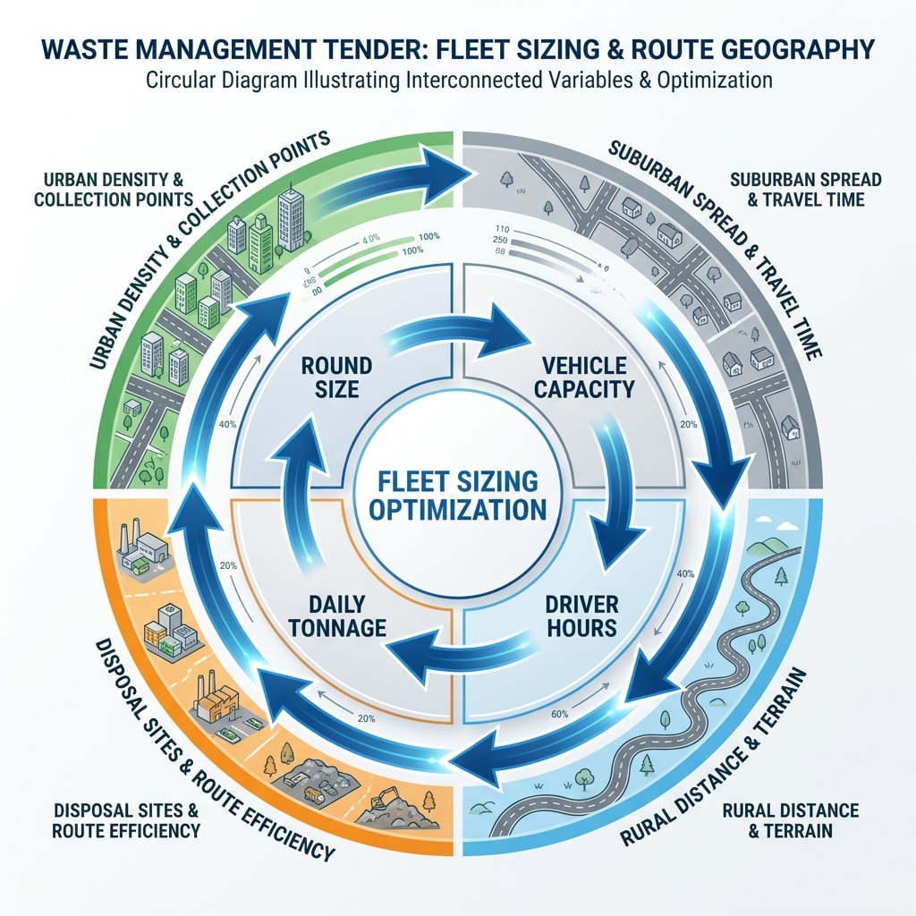
Diagram showing how fleet sizing connects to route geography in waste tenders
The linkage evaluators want to see is:
- Geography defines round count
- Round count defines minimum vehicle requirement
- Vehicle requirement informs fleet composition
- Contingency and maintenance reserve sits on top (typically 10-15%)
If you've designed 14 rounds but are committing 16 vehicles, explain the two-vehicle reserve: maintenance, breakdown contingency, peak demand. Evaluators don't penalise reserves; they penalise unexplained gaps.
Rural Geography Considerations
Rural contracts are harder to model but often less competitive, because fewer bidders have rural operational experience. If you do, use it.
Rural-specific points to address in your response:
- Time windows. Rural properties may only be accessible in certain windows (before school traffic, before farm deliveries). Show you've accounted for this.
- Container access. Farms, rural residential properties, and dispersed industrial units often have access complications. Note how your crew briefing will handle non-standard access.
- Lower density adjustment. Be honest about collection rates in low-density areas. Overstating rural productivity is a common error that shows up when the contract is live.
What Evaluators Actually Score
Most scoring rubrics for this section follow a similar structure. Understanding what sits behind the headings helps you calibrate your response.
"Demonstrates understanding of the contract geography" typically scores on whether you've cited geographic specifics from the area: road types, settlement patterns, the mix of urban and rural collection points. Generic language scores 1 or 2 out of 5. Named streets, population densities, and specific access challenges score 4 or 5. "Proposed round design is operationally credible" is assessed by whether the maths works. Evaluators are checking that your property counts per round, vehicle payload, and shift length align. They're not running your model; they're doing a sense-check. "Evidence base for the proposed design" is where most bidders lose marks. The difference between a 3 and a 5 here is usually just the presence of supporting data: route modelling outputs, benchmarks from comparable contracts, trial run results. "Contingency and resilience" scores on whether you've addressed what happens when the plan doesn't hold: vehicle breakdowns, driver absences, severe weather, unexpected access issues. A short paragraph on operational resilience often moves this from a 3 to a 4.Putting It Together in the Response
Structure matters. A well-structured round design response reads in a logical order and is easy to evaluate.
A workable structure:
- Geographic analysis. What you found when you assessed the contract area. Key characteristics: density, road network, waste stream mix.
- Round design methodology. How you translated the geography into round boundaries. The core calculation. Why the round count is what it is.
- Vehicle allocation. Fleet commitment by vehicle type, mapped to round requirements.
- Performance projections. Estimated collection rates, missed bins KPI, round productivity benchmarks.
- Evidence base. What data underpins the design: software outputs, comparable contract data, trial results.
- Contingency provisions. Reserve fleet, driver availability, breakdown response.
Keep it tight. Evaluators read dozens of these responses. A 600-word section that covers all six points well beats a 1,500-word response that buries the key claims in padding.
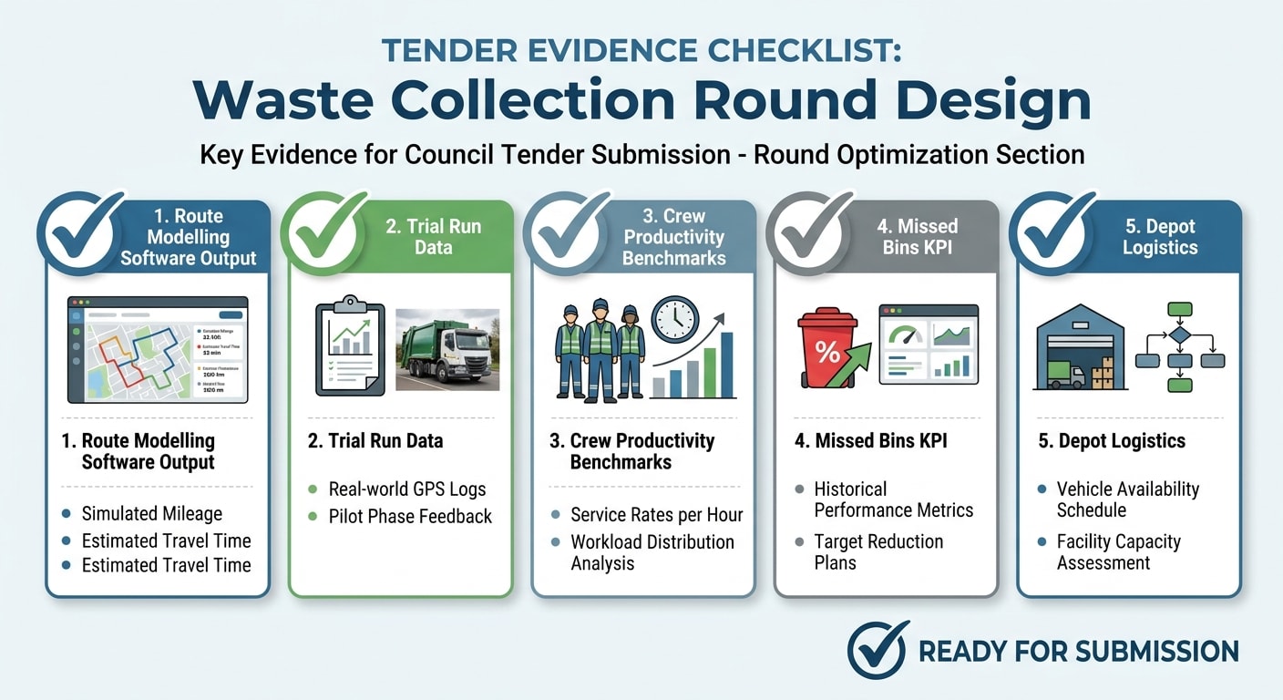
Evidence checklist for waste collection round design tender section
Common Mistakes That Cost Marks
Describing the current contractor's rounds as your own. If the spec includes the current round structure, reference it as a baseline. Don't present it as your proposed design. Evaluators know the difference. Inconsistent numbers. If your methodology says 14 rounds and your fleet section commits 12 vehicles, you've created a contradiction. Check your numbers align across all sections before submitting. Ignoring the Simpler Recycling requirements. Since March 2026, contracts covering residual and recycling should address how your round design accommodates the new separated collection streams. Failing to reference this in a 2026 tender is a missed opportunity at best. Over-claiming productivity. If your proposed collection rate for rural properties is significantly above industry benchmarks, evaluators will notice. Conservative, defensible numbers with a clear rationale score better than optimistic numbers with no backing. Forgetting the depot. Round design without depot logistics is incomplete. Where are vehicles starting from? What's the dead mileage to first collection point? How does shift start time interact with morning traffic on the routes you've chosen?Sourcing Opportunities and Building Your Geographic Picture Early
The earlier you start your geographic analysis, the better your round design will be. For upcoming council waste contracts, finding the opportunity before it's published is a significant advantage: you have more time to model the geography, visit the area, and build relationships with the council's procurement team during any market engagement period.
If you want to see live waste contract opportunities across UK councils before they hit the main portals, the Tender Finder matches opportunities to your sector and region. It's free to use and gives you a head start on geographic preparation.
The Bottom Line
Round design is a technical section, but it's not a technical exercise. It's a test of whether you understand the council's geography and whether you've done the work to prove it.
Do the geographic analysis before you write anything. Model your rounds from first principles. Back every claim with data. Structure the response so evaluators can follow your logic. And keep the numbers consistent across every section.
The councils that evaluate these responses have seen the same generic approaches for years. A bid that shows genuine geographic thinking, credible modelling, and real evidence stands out. That's how you win the marks.
---
mytender.io helps waste management contractors build and manage their bid libraries, so every round design response starts from a base of real data from your existing contracts. Learn more about how it works.Tags
Ready to Transform Your Tender Writing?
See how MyTender's AI can help you write winning tenders in a fraction of the time.